
Skip to content
DAI — Data Analytics Insights
← Back to the Smart City overview

CONNECTED MOBILE SERVICES

Mobile services for people
and city operations.

A modular mobile ecosystem connects residents, visitors and authorized field teams to the same Snap4City platform, municipal data and configured back-office services.

One technological foundation. Different users, workflows and service configurations.

Powered by Snap4Tech
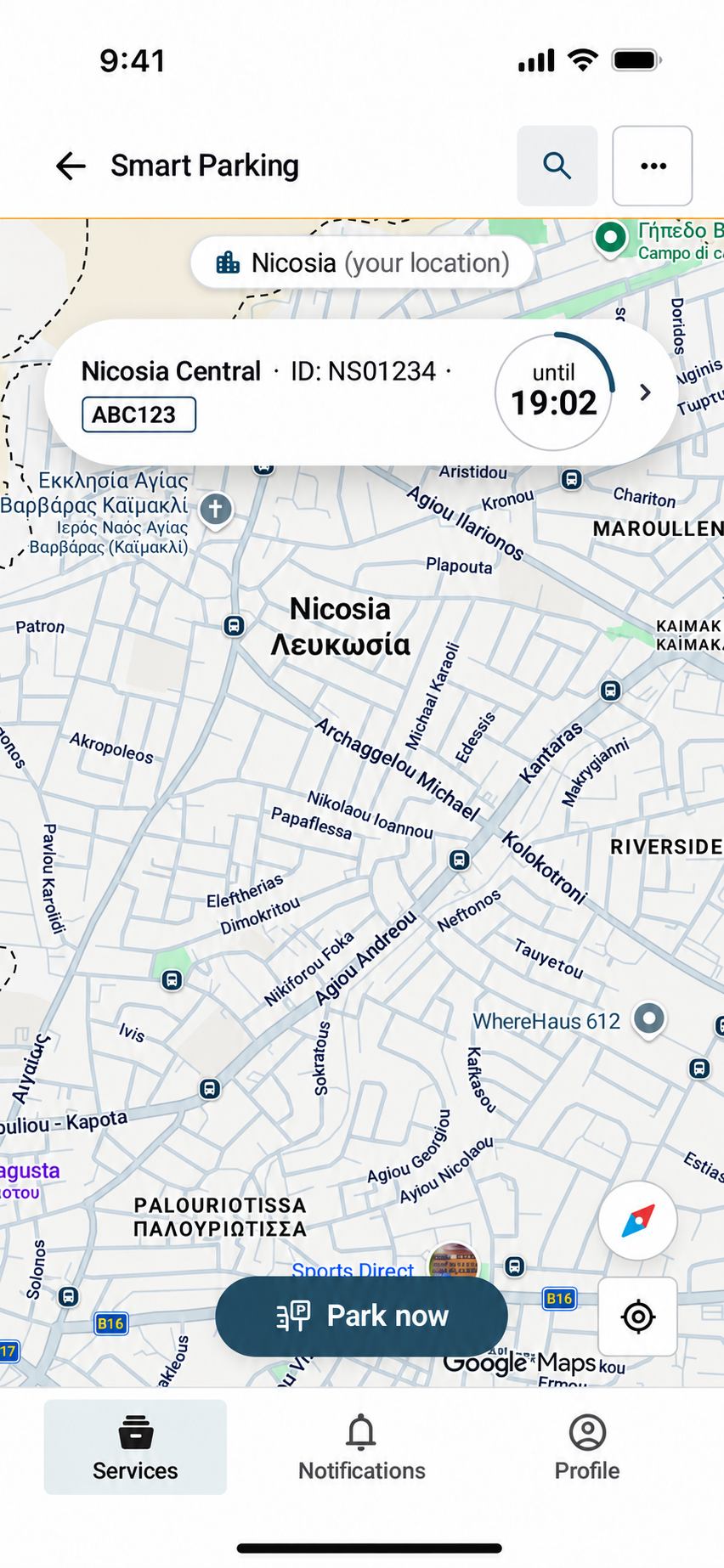
City User App showing an active Smart Parking session on the map
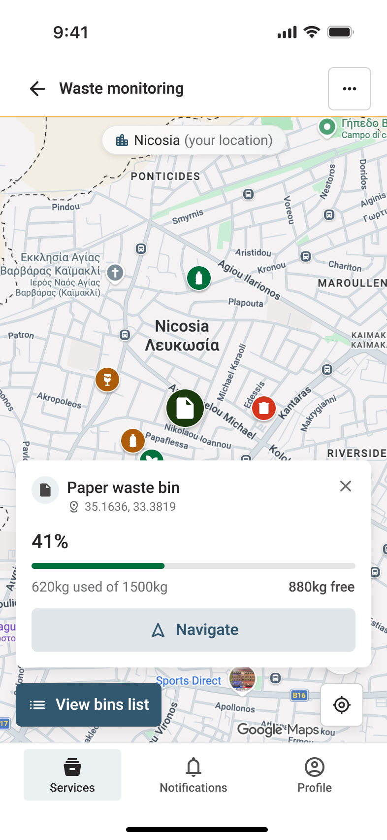
Waste monitoring screen showing bin details, fill level and navigation
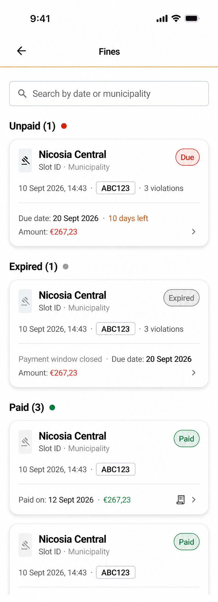
Fines screen showing due, expired and paid parking penalties

THREE ROLE-BASED EXPERIENCES

The right tools for each city user.

Each application focuses on a specific workflow while sharing maps, service data, identity and operational integrations.

For residents and visitors

City User App

Everyday services through one mobile access point.

  • Find parking, compare availability and rates, navigate and pay
  • Manage vehicles, permits, subscriptions and payment history
  • Submit city reports, receive updates and locate nearby waste bins
  • Access mobility, points of interest and environmental information when configured

For on-road officers and municipal enforcement teams

Enforcement App

Field workflows connected with parking and back-office systems.

  • Review live parking status and identify spaces to verify
  • Check plates, parking slots, QR permits and access rights
  • Create fines with photographic evidence and print tickets
  • Coordinate field activity with the configured fine-management back office

For waste truck drivers and collection operators

Waste Collection App

Collection plans, navigation and progress directly in the vehicle.

  • Receive planned routes and build dynamic routes using bin filters
  • Review fill level, bin details and navigation instructions
  • Record completed stops and monitor remaining collection work
  • Connect field activity with fleet, collection and operational KPI systems

CITY USER SERVICES

A service catalogue that can evolve with the city.

Municipalities select the modules relevant to their territory and can add services as new data sources and integrations become available.

Smart Parking

Availability, guidance, sessions, permits and payment options.

Participation and notifications

Geolocated reports, complaint history, operator messages and service alerts.

Payments and fines

Parking and fine payments connected to configured municipal channels.

Mobility and points of interest

Public transport, routes, shared mobility and nearby urban resources.

Environment and weather

Weather, air-quality indicators and environmental information.

Smart Waste

Nearby bins, fill information and collection services for users and operators.

ACCESS AND PERSONALIZATION

Useful without an account. Richer when registered.

Selected information can be available to guests. Registration supports personal services that require an identity, saved data or a service history.

Guest access

Service discovery, maps, nearby resources and public information can be made available without creating an account.

Registered users

Saved vehicles, personal permits, notifications, payment history and participation services can be linked to the user profile.

Authorized operators

Role-based access gives field teams the operational data and tools required for enforcement or collection workflows.

SHARED TECHNOLOGICAL FOUNDATION

Connected to the wider Smart City ecosystem.

The mobile layer can connect with the systems already used by the municipality. The exact integrations depend on the local deployment.

  • IoT and live service data
  • Maps, GIS and Digital Twin services
  • Parking, payment and permit systems
  • Public transport and shared mobility
  • Environmental sensors and urban information
  • Municipal back offices, user roles and analytics

DOCUMENTED APPLICATION SCREENS

Examples show documented application screens. Features, payment channels, permissions, branding, languages and integrations vary by municipality and deployment.

Service catalogue. Users access Smart Parking, municipal reports and nearby waste services from one starting point.
Service catalogueUsers access Smart Parking, municipal reports and nearby waste services from one starting point.
Active parking. The map keeps the current parking session, remaining time and next action visible.
Active parkingThe map keeps the current parking session, remaining time and next action visible.
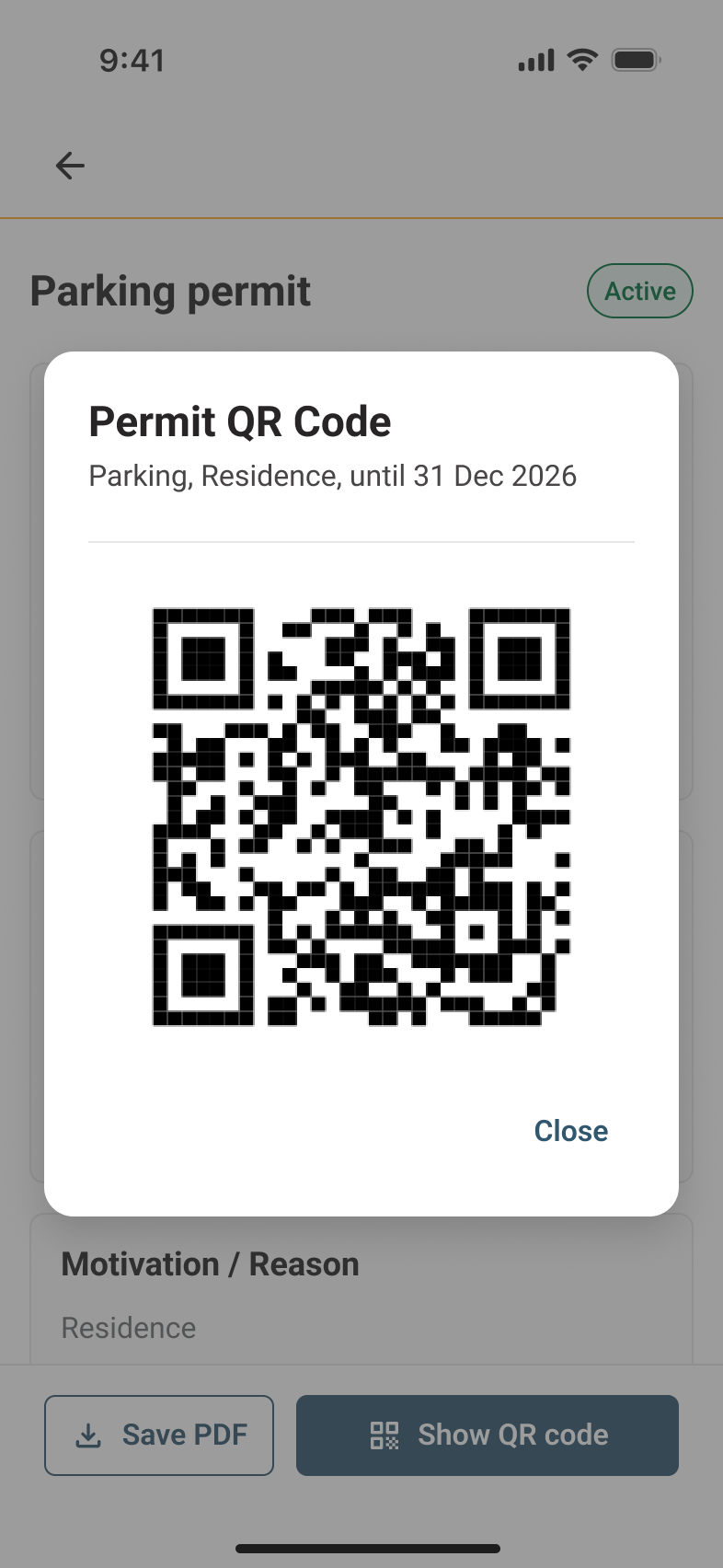
Digital permits. Registered users can open an active permit and present its QR code when required.
Digital permitsRegistered users can open an active permit and present its QR code when required.
Fines and enforcement. Users can distinguish due, expired and paid parking fines and open the related details.
Fines and enforcementUsers can distinguish due, expired and paid parking fines and open the related details.
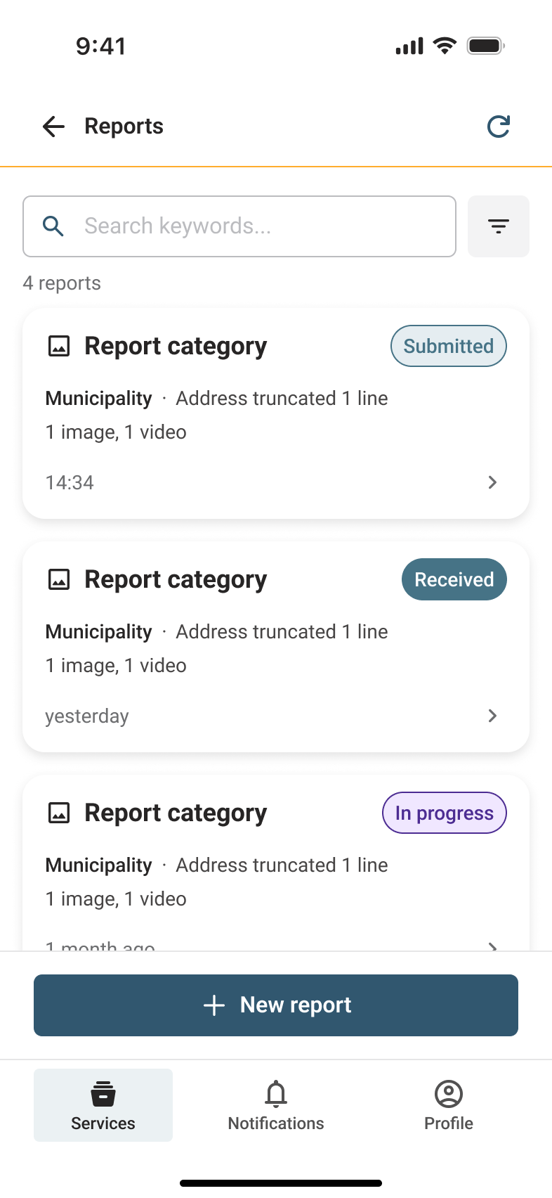
Municipal reports. Submitted reports remain searchable and show their current processing status.
Municipal reportsSubmitted reports remain searchable and show their current processing status.
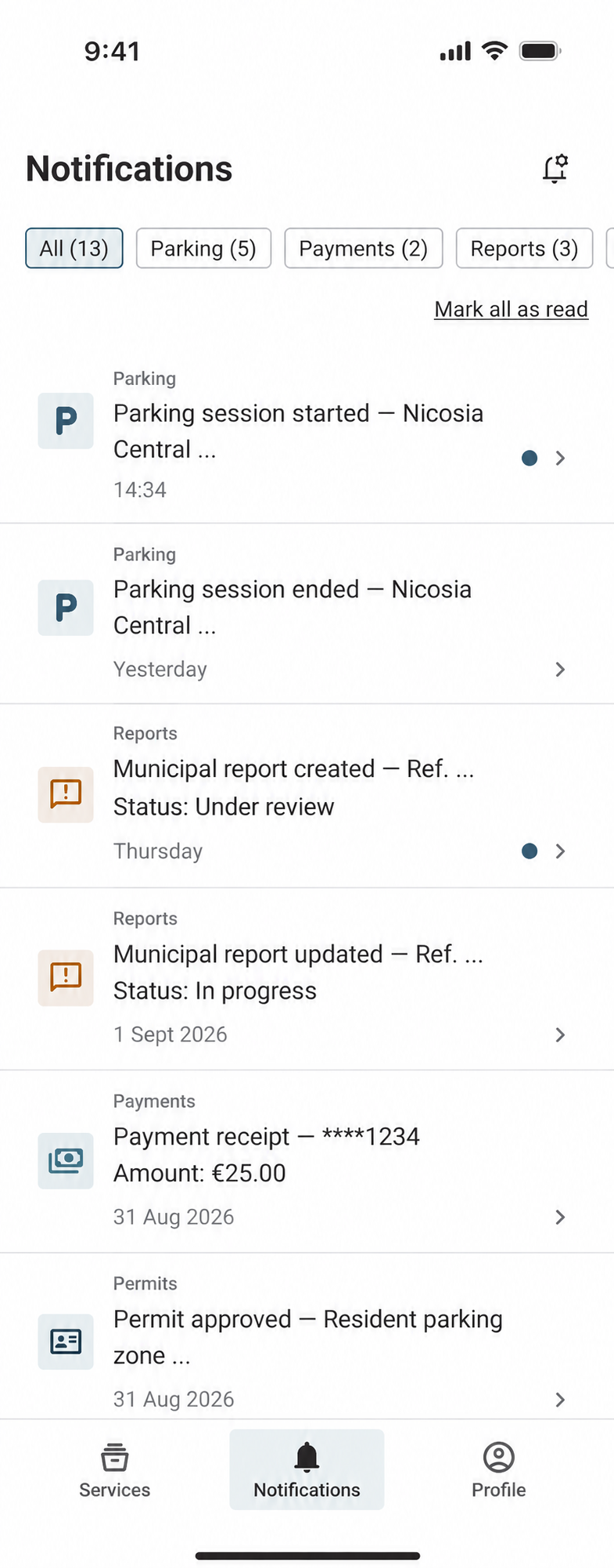
Notifications. Parking, reports, payments and permits are collected in one filtered message history.
NotificationsParking, reports, payments and permits are collected in one filtered message history.
Waste monitoring. Operators can inspect a bin’s location, fill level and available capacity, then open navigation.
Waste monitoringOperators can inspect a bin’s location, fill level and available capacity, then open navigation.
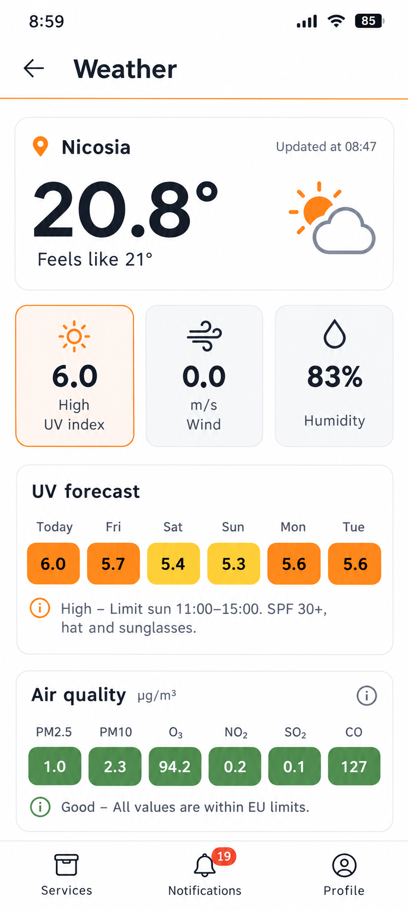
Environment and weather. Users can check local weather conditions and environmental indicators configured for the city.
Environment and weatherUsers can check local weather conditions and environmental indicators configured for the city.

PLAN A CITY DEPLOYMENT

Which services should your mobile ecosystem include?

Define the users, workflows, data sources and municipal systems that the deployment needs to connect.

Discuss a connected city deployment