Understand
Bring heterogeneous data together to see what is happening.

AI · DATA ANALYTICS · DIGITAL TWINS
We turn complex data into insights, predictions and decision support — helping businesses and public organizations understand today and plan what comes next.
Artificial intelligence. Human perspective.
OUR PARTNERSHIP NETWORK
Technology connections that support our work.




FROM INFORMATION TO IMPACT
Start with the question that matters to your organization. Connect the data, understand the patterns and put the insight to work.
Bring heterogeneous data together to see what is happening.
Anticipate trends, demand and anomalies with predictive models.
Explore scenarios to inform operational and strategic choices.
Use the evidence to guide improvements in processes and services.
OUR SOLUTIONS
From predictive models and thermal computer vision to connected mobile services, explore the approach that fits your data and the decisions you need to make.
DECISION SUPPORT & PREDICTIVE ANALYTICS
Bring predictions into the decisions that shape your operations.
A web-based decision-support approach built around predictive models for sales, production and transportation.
Businesses and public administrations planning around changing demand. Product scope and availability are defined with DAI.
Discuss this solution →PRIVACY-PRESERVING COMPUTER VISION
Understand activity through thermal vision, directly at the edge.
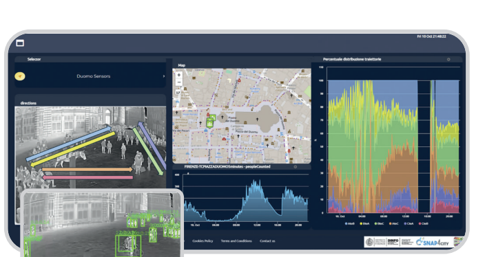
Thermal-camera computer vision for people counting and understanding behavior, with processing designed to operate on the camera.
Situations where people counting and awareness of activity can support operational decisions. Privacy safeguards depend on the deployment.
Discuss this solution →PEOPLE FLOW & BEHAVIOR ANALYTICS
Make sense of how people move through shared spaces.
Thermal-camera analysis for counting and tracking people flows in transport hubs, airports, shopping centers, stores and public spaces.
Understand the use of spaces and transport services to inform planning and service decisions.
Discuss this solution →RETAIL INTELLIGENCE
Connect customer behavior to better retail decisions.
Uses data collected through DAI4Vision and DAI4HubVision to support recommendations for customer experience and retail operations.
Explore shopping patterns and opportunities to improve the customer experience. Outcomes depend on the data and application.
Discuss this solution →CONNECTED MOBILE SERVICES
Bring city services and field operations into one connected mobile ecosystem.
A modular mobile solution for residents, visitors and authorized field teams, connected to the Snap4City platform and configured municipal systems.
Municipalities and public-service operators that want to make services easier to access and coordinate field activities. Available features depend on the local configuration.
Discuss this solution →FROM DATA TO DECISIONS
Data becomes useful when it helps someone act. Our approach connects analysis and prediction with the decisions people make.
WHERE IT APPLIES
Explore potential applications of DAI capabilities. Every project starts by defining the decision, the available data and the operational constraints.
People-flow analysis and predictive models can help inform service and demand planning.
Connect parking, waste, complaints, environment and mobility information in one operational ecosystem, with web and mobile experiences for residents and staff.
People counting and behavioral analysis can help retailers assess the use of spaces and customer experience.
Explore predictive models and scenario analysis for production planning and operational decisions.
Discuss how heterogeneous data, anomaly detection and forecasts could support environmental monitoring.
Assess opportunities for data analysis and simulation to inform resource planning. Specific applications are defined with DAI.
CONNECTED URBAN SERVICES
Bring together service data, operational tools and mobile experiences. The result is a clearer view for public organizations and simpler access for the people who use the city every day.
Find a space. Manage parking.
Live availability and rates, directions, parking sessions, payments, saved vehicles and parking or access permits.
See what needs attention.
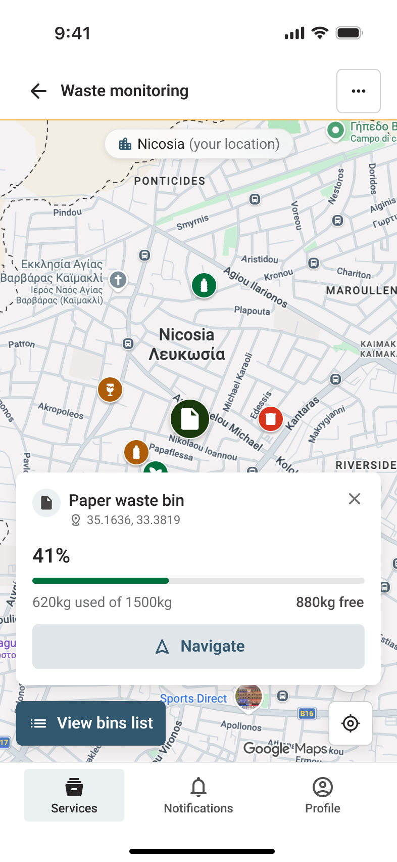
Nearby containers on a map or list, type, coordinates, fill level and directions, with operational data that can support collection planning.
Report. Track. Resolve.
Geolocated complaints with a category, description, photos, a short video or PDF files, plus clear status updates from submission to closure.
From control to notification.
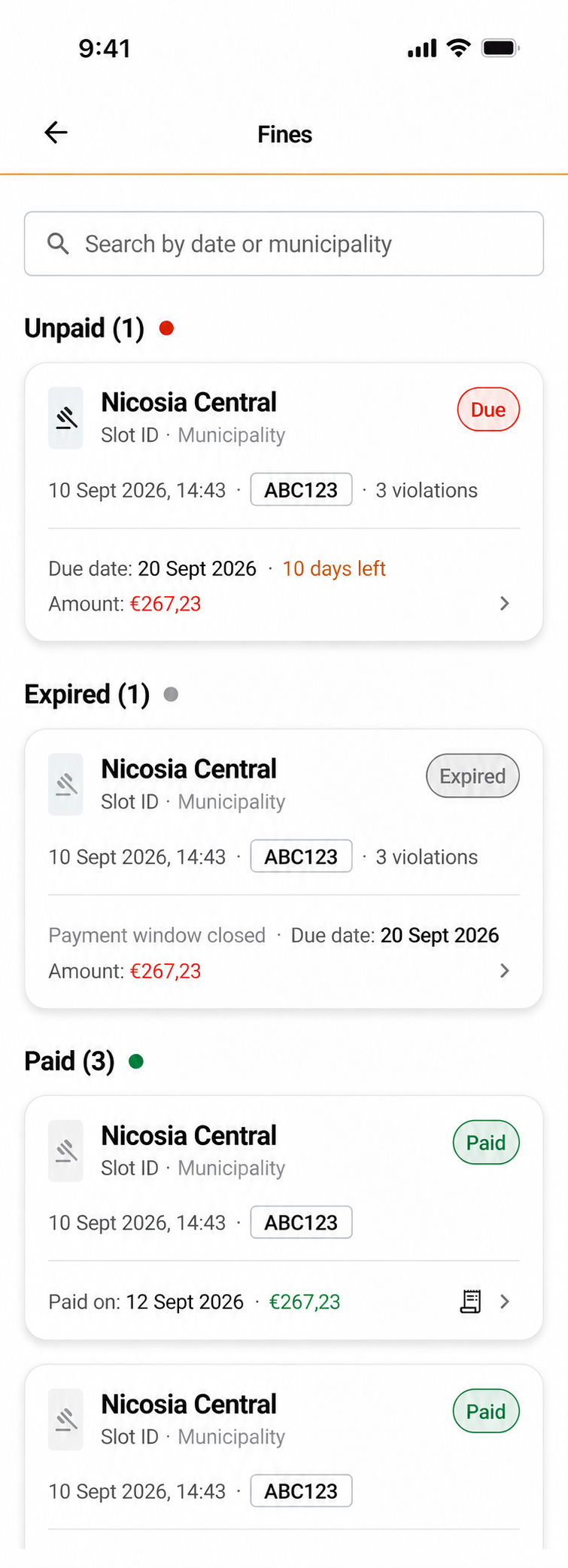
Parking and permit checks support field operations. Residents can receive fine notices, access payment details and review receipts.
Read the city signals.
Sensors, maps and time series help monitor pollutants and environmental conditions, with indicators and forecasts when data and models are available.
Information that keeps people moving.
Traffic, public transport, routes and points of interest become accessible through web and mobile services and support planning decisions.
CONNECTED MOBILE SERVICES
Residents, enforcement officers and waste collection teams use interfaces designed around their own tasks. Each app connects to the same Snap4City platform, municipal data and configured back-office services.
Parking, permits, payments, reports, notifications and nearby city information for residents and visitors.
Live parking status, permit checks, evidence, fine creation, ticket printing and back-office coordination for field teams.
Planned and dynamic routes, bin information, navigation and collection progress for truck operators.
Services, integrations and user permissions are configured for each municipality and deployment. Screens show documented mobile and field applications.
Explore connected mobile services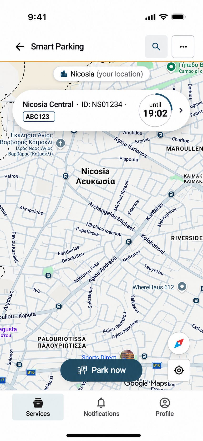
HOW WE WORK
DAI combines explainable AI, intelligent digital twins and open-source technologies to turn data into models, scenarios and visual evidence that people can use.
Methods and technologies are selected around the problem, available data and operating context.
Examine the factors behind model outputs.
Explore scenarios before acting.
AI, machine learning, computer vision, IoT and big data.
Technical depth, visual tools and solutions adapted to context.
DOCUMENTED WORK
Two examples of how DAI connects methods, software and operational use.
THERMAL COMPUTER VISION
A documented software release connects a trained computer vision model with an application for an AXIS edge camera.
CONNECTED MOBILE SERVICES
Role-based applications connect residents, visitors, enforcement teams and waste collection operators to the Snap4City platform and configured municipal services.
Explore DAI4Mobile →LET’S TALK
Tell us about your challenge, the data you have and what you want to understand. We can explore the next step together.
info@d-ai.eu +39 329 983 6864Fields marked * are required.